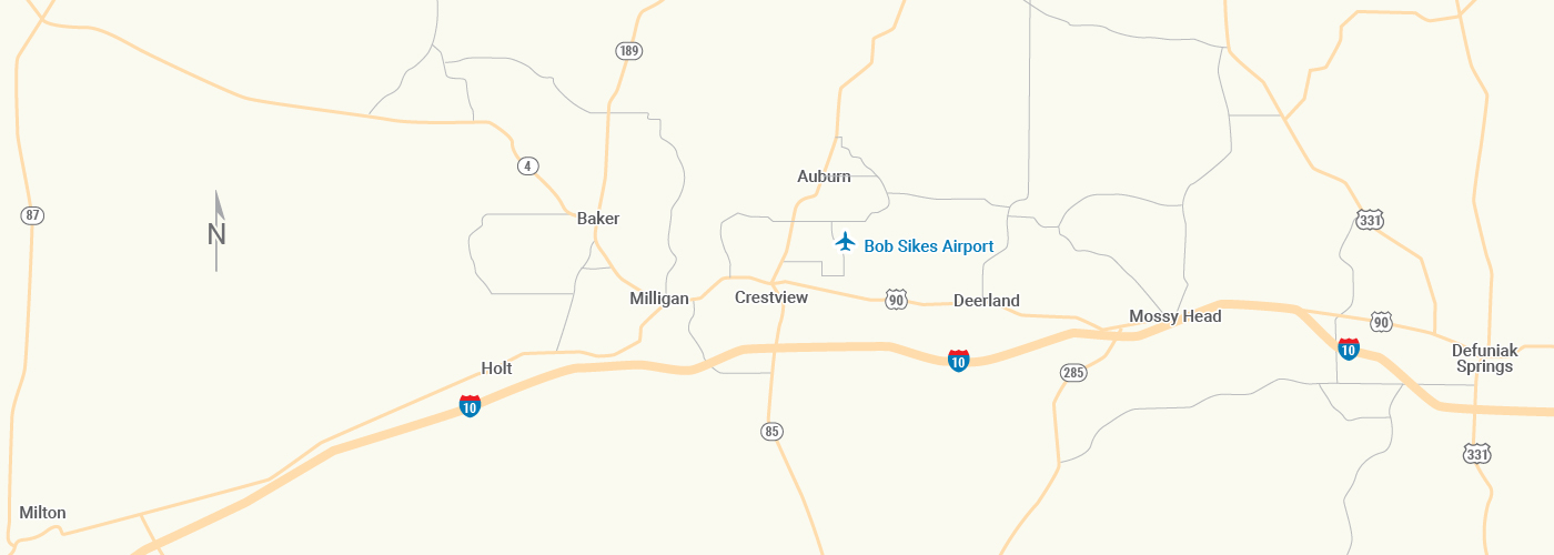
Directions:
Drive times can vary dependent on time of day, distance, seasonal traffic and weather – please plan accordingly!
Our physical address is:
5535 John Givens Road
Crestview, FL 32539
FROM POINTS EAST VIA HWY 20 (Destin East, Sandestin, Panama City, etc.)
Take 20W to 293 N.
Remain on 293 N for approximately 8 miles.
Take the FL-285 N exit.
Travel approximately 12 miles.
Turn left onto US 90 W.
Travel approximately 10.6 miles.
Turn right onto Foy Shaw Pkwy for approximately 1.6 miles.
Bob Sikes Airport will be on your right.
FROM POINTS EAST VIA HWY 98 (Destin East, Sandestin, Panama City, etc.)
Take 98 W to 293 N (Mid-Bay Bridge Route), $4.00 toll. Remain on 293 N for approximately 12.5 miles.
Take the FL-285 N exit.
Travel approximately 12 miles.
Turn left onto US 90 W.
Travel approximately 10.6 miles.
Turn right onto Foy Shaw Pkwy for approximately 1.6 miles.
Bob Sikes Airport will be on your right.
FROM POINTS EAST OR WEST VIA I-10
Take I-10 to Crestview.
Take Exit 56 at Crestview.
Turn North onto 85 N. Travel approximately 3.2 miles.
Take a right onto US 90 E.
Travel 7.2 miles to Foy Shaw Parkway.
Turn left onto Foy Shaw Pkwy for approximately 1.6 miles.
Bob Sikes Airport will be on your right.
FROM POINTS WEST VIA HWY 98
Take 98 E to Mary Esther.
In Mary Esther, turn left onto 393 N (Mary Esther Cutoff).
Turn left onto 189 N (Beal Parkway / Lewis Turner Blvd) for approximately 3.6 miles.
Use the left 2 lanes to turn left onto 85 N for approximately 1.7 miles.
Use the right 2 lanes to turn right onto FL 123 N. Continue for approximately 4.5 miles.
Merge into 85 N for 21 miles.
Turn right onto FL 90 E for 7.2 miles.
Turn right onto Foy Shaw Pkwy for approximately 1.6 miles.
Bob Sikes Airport will be on your right.
.
